Local Storage seems to be disabled in your browser.
For the best experience on our site, be sure to turn on Local Storage in your browser.
Currency
Language


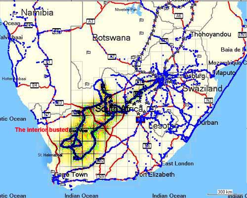
The Vast Interior
Orgonite in the central Karoo
Orgonite busting expedition into the Karoo and Kalahari Easter 2007 Johannesburg 24 April 2007 The target area One of the last white spots of my South African orgonite map, the vast interior semi desert of the Great Karoo, called to be tackled for quite a long time. With the recent unexpected drought in parts of South Africa and neighbouring countries, we felt that closing this giant gap could be the most significant step in order to bring back normal or above normal rainfall like we achieved it for ever larger portions of the subcontinent in 2002-2006.The next step to avoid a repetition of this temporary setback will have to be a much bigger orgonite gifting expedition to Zambia, where we feel the rain that was abundant in Zambia, Malawi and Northern Mozambique and Angola was blocked off along the Zambezi. We are getting ready for this one as we speak.This is what Wikipedia has to say about the Karoo:The Great Karoo has an area of more than 400,000 square kilometers. A vast inland sea covered this region approximately 250 million years ago, but as the world's climate gradually changed from cold to hot the water evaporated, leaving a swamp where reptiles and amphibians prospered.In recent history - less than two hundred years ago - large herds of antelope and zebras still roamed the Karoo's grass flats. The Hottentots and Bushmen, last of the Southern African Stone Age peoples, shared what they called the "Place of Great Dryness" (from which the name "Karoo" is derived). The two groups differed substantially in their cultures and lifestyles; the Hottentots were sheep and cattle farmers while the Bushmen were classic hunter-gatherers. With the occupation of the region by European settler stock farmers the sheep gradually replaced the game, while the grass receded due to the changed grazing and weather patterns."The Karoo is even dryer than the Kalahari which starts north of the Karoo and stretches into Botswana and Namibia, the change being gradual but noticeable.

The blue dots show orgonite gifts distributed on this trip the grey area the estimated sphere of influence of this recent busting effort Due to the vastness of the area and the absence (largely) of conventional targets, such as microwave transmitters, we decided to lay out a string of orgonite TBs every 5 km, with extra orgonite TBs for rivers, including dry river beds, the odd microwave transmitter along the way and special gifts at significant points. This is a similar strategy to what we'd done in Namibia in September 2005 with great success.We were carrying some 850 orgonite TBs, 30 or 40 orgonite HHGs and orgonite Pyramids, several orgonite earth pipes, 2 full grown orgonite CBs and seven single pipe mini CBs. We haven't used those mini CBs before, but felt that they could be a good addition to our arsenal, given how easy they can be hidden in the bush or dug in without the need to find a custodian who will warrant their continued placement. Leg 1: Johannesburg - Sutherland On the first day we left relatively late and only made it to Kimberley which had already been gifted with orgonite in previous expeditions.
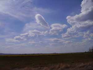
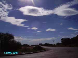
Interesting lenticulars (UFO clouds on way out to Kimberley)
becoming lovely cumulus as we went along gifting orgonite
After Kimberley, our first target town was Prieska. Strangely that little town had always figured big on my list of busting Targets. I can't really give any god reasons for that, except that repeated dowsing with a a pendulum had always shown a strong reaction for this place.
some hint of chemtrails - first in a long time that I see
dissolving as we approach
David Livingstone's first mission church in Campbell
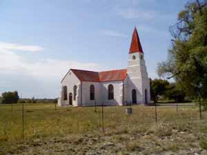
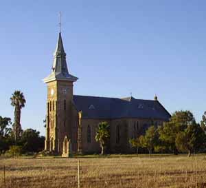
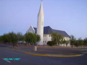
Every conquest of a territory starts with the conquest of the minds of its people. So, in this barren land, the churches stand out as beacons of this strategic spiritual takeover which is not much older than 150 years in most places here. The famous David Livingstone surely played his part in this scheme of things. This may serve as an Explanation why you will see more churches in this report and be assured, they have all been gifted properly.
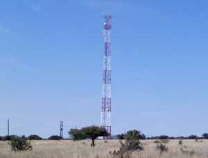
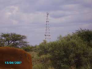
lonesome Kalahari tower in need of orgonite
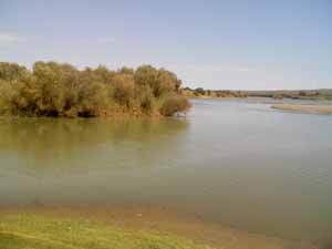
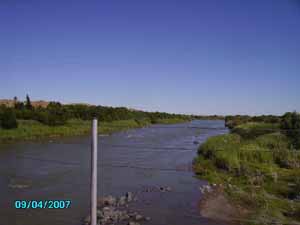
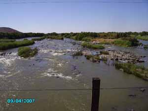
The confluence of the Vaal and Orange rivers
The Vaal and Orange rivers are probably the largest and longest rivers in South Africa. So we felt, that their confluence near Douglas would warrant a first single pipe mini CB and lots of other orgonite in the water and around the place.
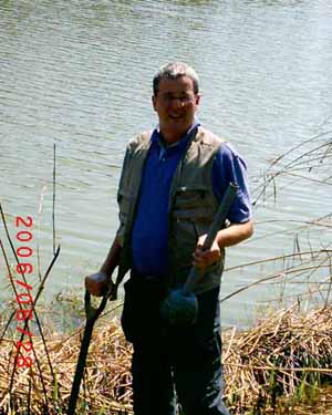
Planting a single orgonite pipe mini CB
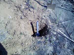
there he sits in the hole
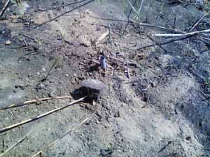
quite inconspicuous - that's the beauty of those minis Prieska received plenty of gifts and another mini near the banks of the Orange River. I seem to have forgotten to make any photos there.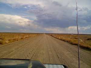
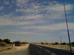
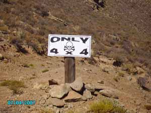
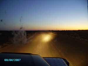
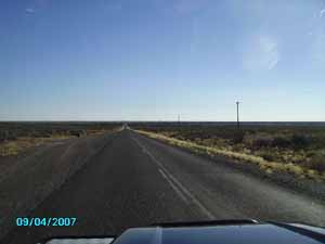
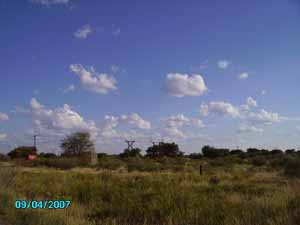
wide open spaces We drove hundreds of kilometres on such gravel roads. The vast interior of South Africa is so thinly populated that the economic activity (mostly sheep farming) does not warrant the building of tarred roads. These are the main arteries of life in this area, not just little farm tracks.
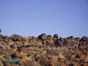
nice stones
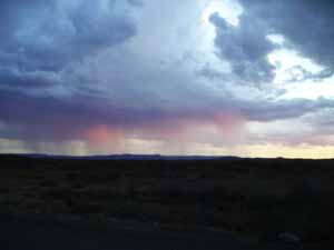
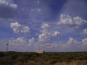
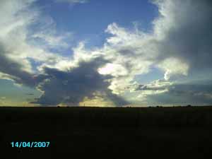
Isolated thundershowers - what a beauty
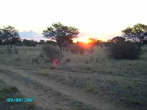
Towards the End of day we witnessed a spectacular sunset near Van Wyksvlei with those isolated streams of rain pouring out of spectacularly illuminated clouds.
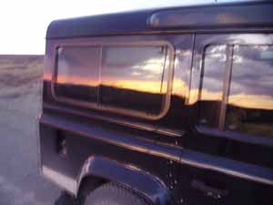
sunset mirrored in car window
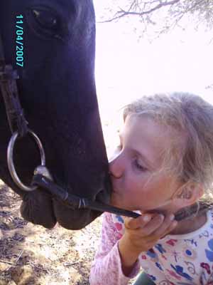
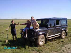
Our Camping spot was approximately 60 km outside Sutherland and we arrived there late at night, only to find the place occupied by droves of heavily partying youngsters. Too bad, but we managed to pitch our tents somewhere and slept to the never ending thump-thump-thump of some very "low vibration music" and the frequent laughter over ever more stupid practical jokes. Next morning then we set out for some horseback riding (no holiday without horses could have any appeal whatsoever for my two girls, Isabella and Katharina)On Easter Sunday we decided to get away from our loud company by going on an extended off-road trail and do some Easter Egg hunting on the way. Maybe we would also find a nice hiding place for our first CB which we intended leaving in this area.
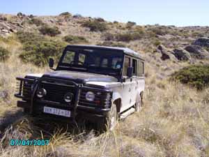
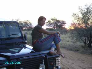
Our new expedition vehicle in adequate surroundings
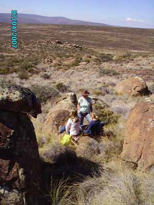
Easter egg hunt in the Karoo
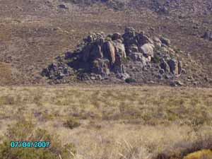
We found a nice picknick spot for our Easter egg hunt and from there spotted an attractive rock formation that promised to provide ample opportunities for hiding a CB.
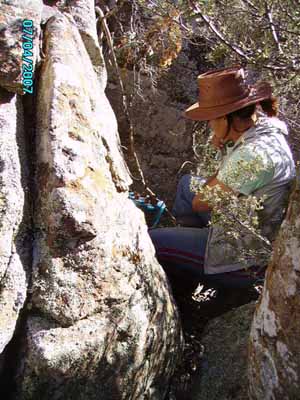
Friederike planting CB in mountain cleft near Sutherland
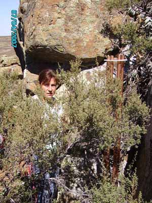
there it is
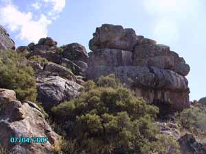
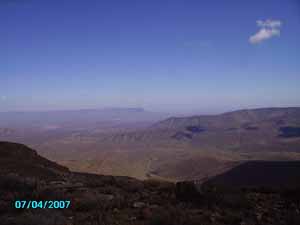
looking back at our CB - who can spot it?The rock formation also looked like a good and powerful spot to amplify the effect of the CB there. Continuing on the 4x4 trail, we saw some amazingly lonely wide open views.
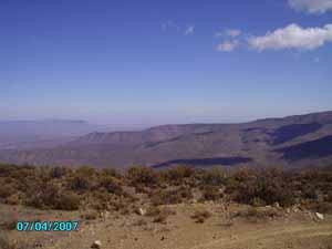
looking down from Karoopunt
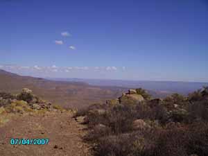
more wide open spaces
this frighteningly steep descent is called "Banggat" in Afrikaans which means "hole of fear"
high pass road in the mountains near Sutherland
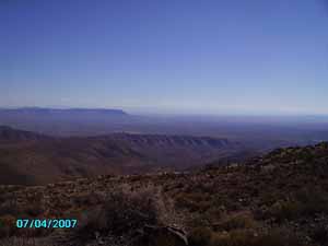
and more of these breathtaking far views
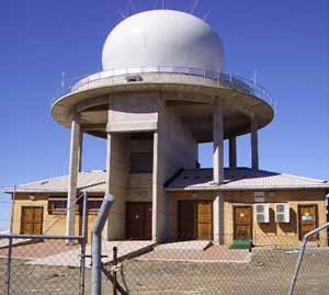
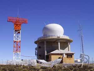
Sutherland is of course world famous for its astronomical observatories. It was chosen as an ideal spot because of it's very dryness, its high altitude and thin population, meaning minimal light emissions from human sources.However we found that apart from environmentally harmless optical telescopes a host of other strange installations had popped up in the surroundings of Sutherland that warranted some close inspection.
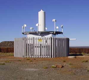
Is it HAARP or memorex?Is this a radio telescope or a microwave ionospheric heater beam? We can only guess, but we felt that leaving a few gifts around could do no harm
weather radar and other high powered transmitters on a lonesome hill near Sutherland
it took us about one hour to get close to this monster and of course ignoring several "Strictly don't enter" signs. These installations are mostly placed in the middle of huge private farms with multiple fences and gates to cross, all complete with the usual "Private Property - Do not trespass" etc. signage.We do act responsibly though and would never leave a farm gate open for example. We have often trespassed on private property on our trips, feeling entitled to such liberty by our conviction that we are doing a public service and that the emissions coming from such installations are violating peoples vital and inalienable right to enjoy a healthy environment and be free from assaults on their very life and vitality."Thou shalt not kill" in other words...
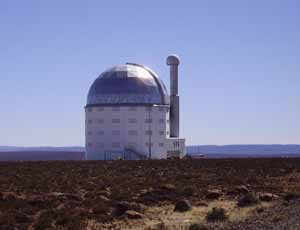
SALT (South African Large Telescope) is the largest telescope in the southern hemisphere
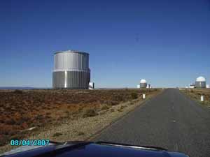
"Astronomy Alley" Quite impressive this line up of scientific gear on the high plateau near Sutherland. We were not allowed to be there, so we hurried to leave some gifts and drove out again. They do public tours on prior appointment but none on public holidays like the one our visit fell onto. Leg 2: Sutherland - North of Kuruman
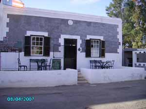
An Oasis in barren Land - Hantam Huis in Calvinia
Another one of those beacons of conquest - Church in Niewoudtsville
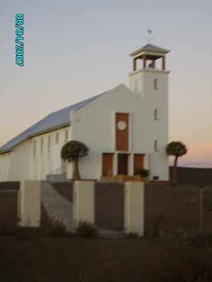
This one in Loeriesfontein looks like a fortress
This one like a very aggressive rocket
Night busting near Williston
Buster's sunrise
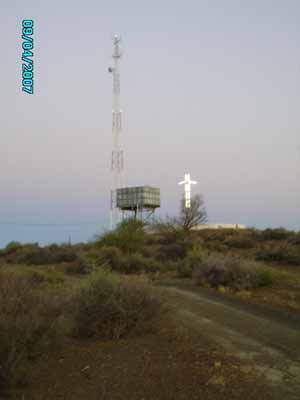
Unholy trinity - the ruling forces in the Karoo as elsewhere
I found this setup noteworthy. Why would one have a death force transmitter, (aka "cell phone tower") an aggressive Christian cross, and the towns central water supply concentrated on one spot?I'd speculate the underlying motto is something like:control their food and drink nuke their brains bind their souls Nowhere as obvious as in these barren lands where everything, including the means of oppression, gets reduced to the naked essentials.
Did Phoenicians roam this inland lake more than 2000 years ago? Now it's a dry salt pan called Groet Vloer Credo Vuzamazulu Mutwa, the custodian of tribal history not only of the Zulu nation, tells of a group of Phoenicians, who sailed up the Zambezi and founded a cruel empire based on enslaving the Bantu people in their area. This may have coincided with the destruction of Carthage by the Romans some 240 Years BC. The Phoenicians were known to the Bantus as the Ma-Iti, the strange ones.Much of the now dry interior of Southern Africa was then much more watery and large inland lakes where found where there are only dry salt pans now, in the Karoo and Kalahari.The center of the empire of the Ma-Iti war a town called Makarikari on a vast inland lake in present day Botswana, which is now a system of dry and shallow salt pans known as the Makgadikgadi pans. The slight shift in spelling is probably due to the modern name being derived from the Tswana language while Mutwa uses the Zulu spelling.But the empire stretched much further into present day South Africa and even as far as present day Swaziland.It was destroyed in a Bantu uprising after flourishing for a few hundred years. Legend has it that the first Monomotapa, the king of the civilisation that built Great Zimbabwe and other similar stone fortresses carried of the stones of the sacked and destroyed City of Makarikari in order to incorporate them into the walls of Great Zimbabwe, possibly in a bid to assimilate the "imperial power" of the Ma-Iti into his own empire.
Strange shiny stones - look like cast iron
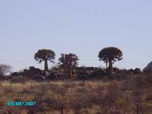
Tree Aloes - a rare sight
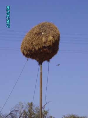
Colonies of social weaver birds indicate we're back in the Kalahari
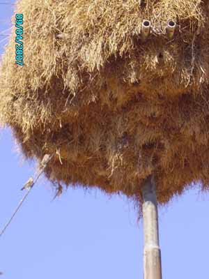
They're a bit like anthills, these giant communal nests.
Oasis on the Orange River: Keimoes
The Orange splits into several arms here and feeds irrigated viticulture
the previously well busted stretch from Uppington to Kuruman looks verdant and the sky quite fresh
Kalahari Sunset 180 km north of Kuruman
A landy is good for many things: Outlook,...
...shaving cabinet
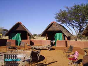
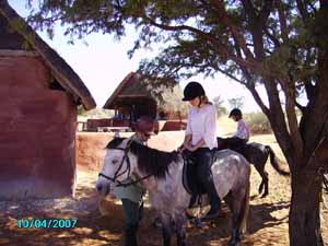
The Bush Camp near Black Rock, where we stayed for 3 nights
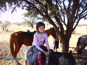
For my kids a holiday without horses wouldn't be a holiday at all
Kika getting comfortable
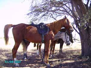
midday's rest
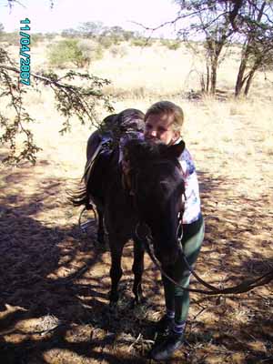
Bella and "her" sturdy little pony
So much love....
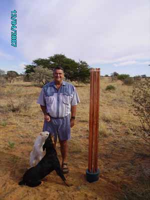
Our host Louis H with his new CB Our host, Louis, proved astonishingly open to the idea of orgone energy, being a very grounded "hands on man", involved in many business and professional activities, besides his large farm. So we were glad to leave a CB in his Custody which will hopefully do some good work for the region. Louis told me that the deep mines in the area had done much to desiccate the landscape with their ground water pumping, needed to keep the shafts free from water.Old rivers that used to flow quite regularly, now stay dry for periods of 15 years and longer.If orgonising those mines can remedy part of that damage?Leg 3: Kuruman - home
A strange show of lenticulars and dissolving HAARP as we move along
Donald Rikiert - The poet of the Kalahari - he's our man for hand mined crystals from the area
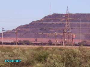
Giant iron ore mine near Sishen - Note the towers on top of the dumps
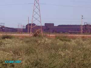
more of that mine - this scar to the earth got well busted

Another tower of power got turned around
This one was in the middle of the game reserve where we spent our last 3 nights, near Kimberley
This is not a postcard
Nice rains around Kimberley - a first reward?
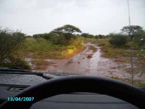
Had to dig him out of the mud
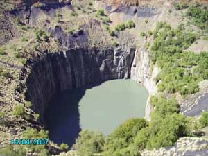
The big hole in Kimberley - revisited
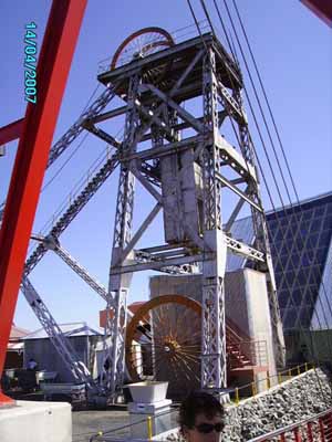
Old head gear and new tourist suspension ramp
This one looks like a mighty and somewhat warlike sylph
The total situation after the tour: Gaps are getting smaller.When we came home we found it had rained there as well and it was to continue raining in un-seasonal but very pleasant quantities.The feeling of drought has disappeared completely and made way to a wonderful freshness.


Filter
Shopping Options
Choose Website
We now have 3 websites for the different world regions. Make sure you are on the right one for correct currency and shipping options.
orgoniseafrica.com
Americas, Oceania, Asia Non EU Europe Central + Northern Africa
orgoniseafrica.eu
All countries in the European Union
orgoniseafrica.co.za
South Africa and neigbouring Southern African countries
Click here for more explanation
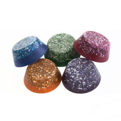
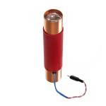
Featured Products

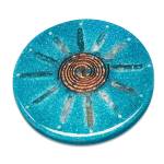
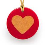
Orgonite pioneers since 2002
Orgonise Africa has been around since the beginning of the orgonite movement and has done much to verify the effectiveness of orgonite with it's successful orgone safaris. Read our expedition reports and info pages! Since October 2002 we produce and sell orgonite devices and zappers worldwide.
We stock a complete range of all healing and gifting orgonite tested and developed over the history of the orgonite movement.
Free shipping
for all orders over 200 U$ world wide and 125 EUR in the EU and 1800 R in South Africa
